
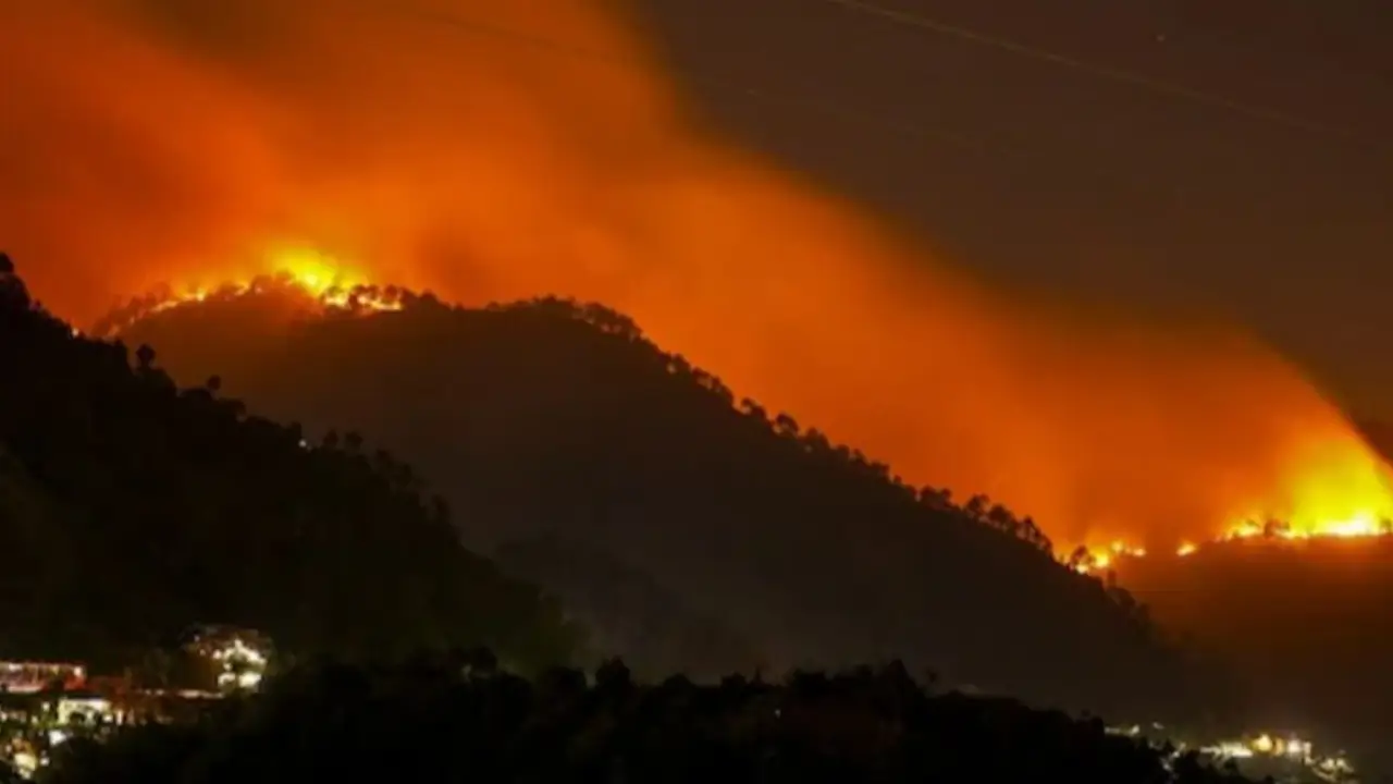
The Day the Forest Changes Without Making a Sound
Imagine standing on a Himalayan hillside on a clear morning.
There is no smoke.
No orange glow.
No helicopter circling overhead.
The forest looks perfectly normal.
Pine needles lie beneath the trees. Birds move through the branches. Villagers walk along familiar paths. Somewhere far below, a road carries the morning traffic.
But several hundred kilometres above the Earth, a satellite is looking at the same forest.
And its instruments may be seeing something that human eyes cannot.
The vegetation is losing moisture.
The soil is becoming unusually dry.
The atmosphere is pulling water from leaves faster than normal.
The forest floor is quietly turning into fuel.
Nothing is burning yet.
But the conditions for burning are beginning to assemble.
This is the intriguing possibility now attracting scientific attention across the Himalayan region: could the forest reveal the approach of a wildfire before anyone sees the first smoke?
The answer is increasingly pointing toward yes, but with an important qualification.
Scientists cannot yet predict the exact tree from which the next fire will start. They cannot know whether a person, lightning strike or accident will provide the spark.
What they may be able to predict is something almost as valuable:
when and where the landscape is becoming dangerously ready to burn.
And that changes the entire meaning of an early warning.
The Fire Does Not Begin When We See Fire
Human beings tend to think of wildfire as a sudden event.
One moment there is a forest.
The next moment there are flames.
Nature is less dramatic than that.
The transformation may begin days earlier.
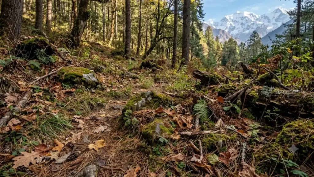
A forest contains enormous quantities of water. Trees draw moisture from the soil and transport it through their tissues. Leaves release water into the atmosphere. The soil acts as a reservoir. Dead leaves, grass and fallen needles form a layer of potential fuel.
As this system dries, the forest gradually changes character.
The colour may barely change.
The landscape may look almost identical.
But its flammability can change substantially.
That is why moisture is so interesting to wildfire scientists.
The question is not merely whether the forest is green.
It is whether the vegetation and fuel contain enough moisture to resist ignition and slow fire spread.
This distinction is becoming particularly important in the Himalayas, where steep terrain, fragmented forests, seasonal dryness and human activity can combine to turn a relatively small ignition into a rapidly spreading fire.
The Invisible Pull of Dry Air
There is another invisible character in this story: the atmosphere.
Scientists call one of its most important measurements vapour pressure deficit, or VPD.
The simplest way to understand VPD is to imagine the atmosphere as having a thirst.
When VPD is high, the air has a greater capacity to draw moisture from vegetation and soil.
So two forests can experience the same temperature but have very different fire risks.
One may be relatively moist.
The other may be losing water rapidly.
That is why temperature alone can be a poor wildfire-warning system.
Recent Himalayan research has increasingly connected high VPD, declining soil moisture and vegetation drying with greater fire risk. Studies of Himalayan fire behaviour have identified atmospheric dryness as a particularly important environmental factor.
The implication is subtle but profound:
the atmosphere may begin preparing the forest for fire before the fire itself exists.
A Satellite Can See the Forest Becoming Thirsty
This is where the story moves from the mountains to space.
Satellites cannot smell smoke.
They cannot hear the crackling of dry leaves.
But they can measure changes in the landscape.
Different instruments reveal different pieces of the puzzle.
One measurement detects surface temperature.
Another estimates soil moisture.
Another observes vegetation condition.
Thermal sensors can identify active fires.
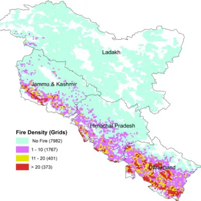
Historical satellite records reveal where fires repeatedly occur.
Put those signals together and scientists can begin asking a new question:
Is this forest merely warm or is it entering a dangerous state of dryness?
India already has a sophisticated foundation for this approach.
The Forest Survey of India (FSI) monitors forest fires using NASA’s MODIS instruments and the SNPP-VIIRS sensor. MODIS observations have approximately 1-kilometre resolution, while VIIRS provides approximately 375-metre resolution. FSI says these systems provide alerts to State Forest Departments at least six times in 24 hours.
That sounds like a futuristic system.
But India has been developing it for years.
FSI began disseminating MODIS-based forest-fire alerts in 2004. SMS alerts followed in 2008. Pre-warning pilots were conducted in Uttarakhand, Himachal Pradesh and Madhya Pradesh in 2016. VIIRS was incorporated in 2017, while the FSI Van Agni Geo-portal and Fire Weather Index-based pre-fire alerts followed in 2019.
The fascinating part is what comes next.
The satellite does not have to wait for flames.
India’s System Is Already Trying to Predict the Fire
FSI’s Forest Fire Danger Rating System uses weather, forest fuel and terrain conditions.
The system operates on 5 km × 5 km grids and uses the Fire Weather Index framework. Its components include measures related to fuel moisture and fire behaviour. As fuel becomes drier, the moisture-related danger ratings increase.
The resulting danger categories range from Low Risk to Extreme Risk.
During the fire season, FSI disseminates pre-fire alerts for the highest-risk categories. The information is made available through its Van Agni Geo-portal.
This is an important distinction.
A conventional fire alert says:
Something is burning here.
A pre-fire warning attempts to say:
Conditions here are becoming unusually favourable for burning.
That is the beginning of prediction.
The Himalayan Forest Is Not One Forest
There is another mystery hidden inside the mountains.
The Himalayas are not a single ecological system.
The forests of Uttarakhand are different from those of Himachal Pradesh. The eastern Himalayas differ again. Elevation, rainfall, vegetation, human settlement and seasonal dryness change dramatically across relatively short distances.
Consequently, there cannot be one simple Himalayan fire formula.
A dry pine slope may behave differently from a moist temperate forest.
A forest near a road may face different ignition pressures from a remote forest.
A village surrounded by agricultural land has a different risk profile from a settlement deep inside a protected landscape.
This is why the future of wildfire forecasting will probably depend on high-resolution local risk maps, rather than one giant Himalayan danger number.
The Pine Needles That Wait on the Ground
Walk through some Himalayan forests during the dry season and another part of the mystery becomes visible.
The forest floor can become carpeted with fallen pine needles.
Individually, each needle looks harmless.
Together, when sufficiently dry, they become fuel.
Chir pine landscapes are particularly important in parts of the western Himalayas. Research has linked Himalayan fire activity with pre-monsoon dryness and the accumulation of combustible material, including pine litter.
But there is a dangerous temptation to blame the tree.
That would oversimplify the problem.
A dry forest does not automatically produce a wildfire.
Something must ignite it.
Human activity is therefore a critical part of the equation.
Agricultural burning, unattended fires, roadside ignition, tourism, electrical faults and other human sources can provide the spark. Once that spark enters an exceptionally dry fuel bed, environmental conditions determine how easily it becomes something much larger.
The real danger is therefore not simply:
pine + heat = fire.
It is:
dry fuel + dry atmosphere + suitable weather + ignition + terrain = rapidly escalating fire.
Can Satellites See the Danger Days Before Smoke?
This is where scientific honesty matters.
The answer is potentially but not with the certainty of a weather clock.
Researchers are becoming increasingly capable of identifying periods when the environment is primed for wildfire.
But a high-risk map does not mean a fire will definitely occur.
Think about a storm warning.
A weather service can identify conditions favourable for severe thunderstorms. It cannot guarantee that lightning will strike one particular tree.
Wildfire forecasting faces the same problem.
The environmental conditions can be forecast.
The ignition event often cannot.
This creates three different levels of prediction:
| Warning level | What can realistically be predicted |
| Weeks ahead | Seasonal dryness and broader climate-related risk |
| Days ahead | Soil moisture, vegetation stress, VPD and weather-driven fire danger |
| Hours ahead | Active hotspots and developing fires through satellites |
The real scientific breakthrough would therefore not be a magical prediction saying “a fire will start here on Thursday.”
It would be a probability map saying:
“This landscape is becoming unusually capable of sustaining a fire.”
That is enough to change behaviour.
Climate Change Adds Another Layer to the Mystery
The Himalayas are already experiencing a changing climate.
But wildfire risk does not depend only on whether average temperature rises.
What matters is the interaction between heat, moisture and atmospheric demand.
A warmer atmosphere can increase evaporative demand. A prolonged rainfall deficit can reduce soil moisture. Changes in snow and winter precipitation can alter water availability before the dry season.
The result can be a forest that dries faster or remains dry for longer.
That is why scientists increasingly examine drought and atmospheric dryness alongside temperature.
In other words, climate change can influence wildfire risk without simply producing a hotter thermometer reading.
The forest does not ask:
“How many degrees warmer is it?”
It effectively responds to another question:
“How much water do I have and how quickly am I losing it?”
That may be the more important question for future Himalayan fire management.
The Most Vulnerable People May Be Living Closest to the Forest
The people most exposed are not necessarily those living in the largest cities.
They are often communities living at the forest boundary.
For them, a wildfire can become much more than an ecological event.
It can threaten homes, livestock, fodder, agricultural land, drinking-water sources, forest products and local income.
Remote communities also face another problem:
distance.
A fire may be detected quickly from space, but reaching it physically can take much longer.
A satellite can see a hotspot in seconds.
A forest crew still has to cross the mountain.
That difference between detection time and response time may become one of the central challenges of Himalayan wildfire management.
This is why early warning has value even when prediction is imperfect.
If authorities know that a particular forest is entering an extreme-risk period, they can move equipment, increase patrols, clear strategic fire lines and alert communities before the first emergency call arrives.
The Old Knowledge Hidden Below the Satellites
There is another source of information that modern technology should not ignore.
The people who live beside Himalayan forests have been observing them for generations.
They know where springs disappear first.
They know which slopes dry rapidly.
They know where fallen vegetation accumulates.
They know which pathways become difficult during the fire season.
They know how smoke behaves in particular valleys.
A satellite may detect a moisture anomaly across thousands of square kilometres.
A villager may know what that anomaly means on one particular hillside.
This suggests that the future should not be a battle between indigenous knowledge and satellite science.
It should be a partnership.
Imagine a warning system that combines both:
Satellite: vegetation moisture has fallen sharply.
Weather model: VPD is unusually high.
Forest database: this slope has a history of repeated fires.
Local observer: the forest floor is exceptionally dry.
Government system: fire crews are moved closer.
That is no longer simply fire detection.
It is fire intelligence.
The Warning System India Could Build
India already possesses many of the necessary components.
The next step would be to connect them more tightly.
A future Himalayan wildfire system could work like this.
First: watch the moisture
Satellites and ground sensors monitor soil and vegetation moisture.
Second: watch the atmosphere
Weather forecasts track temperature, humidity, wind and VPD.
Third: watch the fuel
Maps identify pine litter, dry grass, forest type and other combustible material.
Fourth: watch the terrain
Slope and elevation indicate where fire could spread rapidly.
Fifth: watch human activity
Roads, settlements, farms, tourist routes and historical ignition points identify likely sources of fire.
Sixth: ask the local population
Forest guards, village volunteers and community organisations provide ground-level observations.
Seventh: turn data into action
Instead of sending complicated scientific datasets to villagers, authorities could issue simple warnings:
GREEN — Normal
YELLOW — Drying
ORANGE — High Fire Danger
RED — Extreme Fire Danger
The objective would be simple:
move prevention ahead of ignition.
The Most Important Number May Be the One We Cannot Yet Calculate
Imagine a satellite system announcing tomorrow:
“Fire danger in this Himalayan district is 80% higher than normal.”
What would that actually mean?
It would not mean that 80% of the forest will burn.
It would mean that the environmental conditions resemble situations historically associated with elevated fire risk.
This distinction matters because wildfire prediction is probabilistic.
A good early-warning system should therefore communicate risk, not certainty.
That may actually make it more useful.
A village does not need to know whether a fire will definitely occur.
It needs to know whether today is a good day to leave a burning pile unattended.
A forest department does not need perfect prediction.
It needs enough warning to move people and equipment before conditions become dangerous.
The Future May Be a Forest That Watches Itself
The most intriguing possibility is that Himalayan wildfire management could eventually become a continuously learning system.
Satellites observe.
Weather stations measure.
Ground sensors report.
Villagers contribute observations.
Artificial intelligence compares today’s landscape with decades of historical data.
Every new fire teaches the system something.
Over time, the question changes from:
“Where are fires happening?”
to:
“What combination of conditions repeatedly happens before fires?”
That is a much deeper question.
And perhaps the most important discovery will not be a single satellite image or a single algorithm.
It will be the discovery of a sequence.
A particular decline in soil moisture.
Followed by unusually high atmospheric dryness.
Followed by vegetation stress.
Followed by hot, windy conditions.
Followed by ignition.
If that sequence can be identified reliably enough, the forest could effectively provide its own warning.
Not by speaking.
By changing.
The Himalayan Fire May Already Be Visible—If We Know Where to Look
For centuries, people waited for smoke.
Then came watchtowers.
Then aircraft.
Then satellites.
Now the science is moving one step further.
Perhaps the next generation of wildfire warning will not wait for the fire at all.
It will watch the conditions that make fire possible.
India’s Forest Survey of India already operates near-real-time satellite monitoring, large-fire tracking and Fire Weather Index-based pre-fire danger assessment. Its system uses MODIS and VIIRS observations and provides pre-fire risk information to forest authorities.
The opportunity now is to make that intelligence more predictive, more local and more connected to communities.
Because the most dangerous moment may not be when flames appear.
It may be the quiet afternoon before them.
The forest is still green.
The mountains are still beautiful.
There is no smoke in the sky.
But beneath the trees, moisture is disappearing.
And hundreds of kilometres above, a satellite may already be noticing.
The next Himalayan wildfire may announce itself long before it becomes visible to the human eye.
The real challenge is whether we will learn to listen.
Key Unfoldings
- Wildfire risk can develop before visible flames or smoke.
- Soil moisture, vegetation moisture and atmospheric dryness can provide valuable early signals.
- Vapour pressure deficit (VPD) is an important measure of the atmosphere’s drying power.
- India already has satellite-based near-real-time fire detection and pre-fire danger systems.
- FSI receives MODIS and VIIRS fire observations at least six times every 24 hours.
- FSI’s Fire Weather Index system incorporates fuel moisture, weather and terrain information on 5 km × 5 km grids.
- Exact ignition cannot currently be predicted reliably weeks in advance.
- What can increasingly be forecast is the probability that environmental conditions will support a serious fire.
- Himalayan communities living near forests can provide ground-level information that satellites cannot.
- The most effective future system will combine satellites + weather + vegetation + terrain + historical fire data + local knowledge.
Frequently Asked Questions
Can a wildfire really be predicted before smoke appears?
Its exact ignition cannot reliably be predicted, but scientists can increasingly identify environmental conditions associated with elevated wildfire probability.
What changes first before a forest fire?
Often the moisture balance changes first. Soil dries, vegetation loses water and atmospheric demand increases. These changes can make vegetation and forest litter increasingly combustible.
Why are satellites useful?
Satellites can repeatedly observe huge and inaccessible mountain landscapes and detect changes in temperature, vegetation and fire activity that cannot be monitored everywhere from the ground.
Can India already issue pre-fire warnings?
Yes. FSI operates a Fire Weather Index-based Forest Fire Danger Rating System and disseminates pre-fire alerts during the fire season.
Can climate change increase Himalayan wildfire risk?
Climate change can alter temperature, precipitation, soil moisture and atmospheric drying. The interaction of these factors can create more favourable conditions for wildfire in some Himalayan landscapes.
Are local communities important to wildfire prediction?
Extremely. Satellites provide regional measurements, while local communities can provide observations about fuel conditions, unusual dryness, ignition activity and difficult terrain.
Authentic Sources & Government Links
Forest Survey of India — Forest Fire Monitoring and Early Warning
FSI’s official information on MODIS, VIIRS, near-real-time monitoring, Fire Weather Index, pre-fire alerts and Van Agni.
Forest Survey of India – Forest Fire Management
Forest Survey of India — Forest Fire Activities
Official history and statistics of India’s satellite-based forest-fire monitoring system.
FSI Forest Fire Activities
Forest Survey of India — Technical Information Series
Official technical publications on fire-prone forest mapping and the FSI Forest Fire Alert System.
FSI Technical Information Series
Ministry of Environment, Forest and Climate Change, Government of India
MoEFCC official website
India State of Forest Report — Forest Survey of India
The official national source for India’s forest-cover and forest-resource assessments.
Forest Survey of India
A final caution about the numbers
Satellite fire statistics should not be interpreted as an exact count of every ground-confirmed fire. Different sensors have different spatial resolutions, observation times and detection limitations. A hotspot detection is not automatically equivalent to a separately verified wildfire.
That distinction becomes especially important in the Himalayas, where clouds, steep terrain, small fires and difficult access can affect both satellite detection and ground verification.
The strongest conclusion, therefore, is not that science can now predict every Himalayan wildfire.
It is something more interesting:
The forest appears to change its behaviour before it burns and satellites are increasingly capable of seeing those changes.




Leave a Reply